


DIFFERENT APPLICATIONS PAYLOAD
up to 30kg
The maximum payload of 30 kg can be used to deliver sensitive monitoring
instruments to a required location or to follow a defined flight path, and to return
them to base without the complexity and costs of a fully manned mission. Using
the datalink, payloads can be remotely controlled and powered with up to 1,000 W for all SSD UAV payloads.
DIFFERENT APPLICATIONS PAYLOAD
The maximum payload of 30 kg can be used to deliver sensitive monitoring instruments to a required location or to follow a defined flight path, and to return them to base without the complexity and costs of a fully manned mission. Using the datalink, payloads can be remotely controlled and powered with up to 1,000 W for all SSD UAV payloads.

direct control mode
Video and Control
direct control mode
Video and Control
Operating ceiling
3000m
Operating ceiling
3000m
Frequency used: 5 - 6 GHz (4W)
Available ranges: 40 km, 100 km and 200 km.
UAV LIFE CYCLE SUPPORT – “ONE STOP SHOP” FOR ALLSERVICES
Acquisition
UAV acquisition as per customer ́s specification including payload UAV leasing as per customer ́s specification including payload UAV as a service using company-owned UAVs with pre-defined configuration Other UAV services as per mutual agreement
Training
Theoretical education of the pilots and operators Simulator training using Virtual Reality headsets and simulators Flight training with scaled-down and full-sized UAVs All activities at own airfield with asphalt runway and dedicated airspace
Maintenance support
Scheduled maintenance with spare parts deliveries Unscheduled maintenance with deployable teams Remote online support for systems calibration Removed parts swap service and spare parts delivery
Depot level maintenance
Unscheduled maintenance after airplane damage Remaining service life assessment and its extension Modification of the airplane configuration for new payloadGround control station refurbishment after extensive use implementationNew components and systems installation New payloads integration and installation Ground control station upgrading for higher computing capability
Upgrades and Updates
Service bulletins check and implementation New components and systems installation New payloads integration and installation Ground control station upgrading for higher computing capability
Operational Support
Assessment of customer ́s intent and capabilities to operate the UAVs Legal support of the operation within the customer ́s country Technical support for UAV inventory setup and operation startup Online access to manuals, service bulletins and flight logs

LOW FUEL CONSUMPTION
5l /h
LOW FUEL CONSUMPTION
LONG-RANGE FLIGHT
up to 2500 km
LONG-RANGE FLIGHT
Anti jamming
Protection sytem
Anti jamming
AIRSPACE NAVAID SYSTEMS CALIBRATION
The SAFESKYDRONE long range UAV may be equipped with Flight Inspection System (FIS) payload to support the calibration of enroute- and airport NAVAID's such as ILS, VGSI, VOR, DME, NDB, Marker, GBAS, VDF and other. Sensors for military NAVAID's such as TACAN and Precision Approach Radar (PAR) can also be provided. The airborne avionics sensors and the GNSS/SBAS positioning system provides high accuracy measurements that are transmitted over high speed datalink, providing real-time data and results to the Flight Inspector on ground. The high-end Flight Inspection software allows the results of the inspection to be exported to any customized report format.
ELECTRONIC WARFARE
One of the world beating features of the SAFESKYDRONE long range UAV is its capability for Electronic Warfare deployment. The plane can be equipped with a sophisticated ITAR-free set of electronic and radio-frequency jammers and receivers allowingit to perform electronic attacks, stand-off jamming, stand-in jamming, self- protection and convoy protection jamming, threat emitter simulation, emitter simulation during jamming, electronic protection training and other missions. At a small percentage of the cost of currently used Electronic Warfare systems, the SAFESKYDRONE long range allows unparalleled capability in the area of traditional and modern coherent jamming or a combination of these for an affordable cost without any export restrictions. Its long endurance of 15 hours together with a200 km LOS range ensures a true stand-off capability.
PIPELINES AND ENERGYLINES MONITORING
For the oil and energy industry the SAFESKYDRONE long range UAV brings a cost-effective platform for daily use with sophisticated technology and automatization of pipelines and transmission line monitoring. The plane is operated and controlled from a Ground control station with very advanced level of automatization for easy mission planning and preparation. Due to the LOS range of 200 km and operating speed of up to 150 km/h it can provide a higher monitoring capacity than any other platform, no matter if manned or unmanned. The sensor suite can consist of a day HD camera, day/night HD camera, ultra- high resolution (150 MPix) still camera, laser LIDAR scanner or other sensors. All items are equipped with self-alignment capability and GPS localisation function to provide real-time transfer of gathered data to the Ground control station and optionally to the operator ́s HQ.

Payload packages can alternatively include radio relays and electric warfare/countermeasure equipment.
All parameters are adjustable according to Client’s needs
GROUND CONTROL STATION is A ONE BOX SOLUTION, JUST CONNECT ANTENNA
SAFESKYDRONE The ground based part of the Flight Control System is all managed from one box that is portable and complete. To setup up, open the box, connect theantenna and turn it on:
Datalink + related systems. All mounted into a robust transportation box.
GCS
Central computer
Software
Joystick for manual flight mode
Antenna system
Camera operator display + management console

FLIGHT CONTROL SYSTEM
The SAFESKYDRONE UAV has a unique advanced Flight Control System. The plane is controlled remotely during all its flight phases and has the ability to start, land and conduct a flight completely automatically according to its flight plan. In the UAV, the Flight Control System is handled by the autopilot and datalink with multiple redundant CPUs.
The autopilot provides safe and controlled execution of remote flight plans
including:
Auto take-off
Auto flight plan execution (waypoints)
Fly-to
Hover/hold and Follow Target
Auto Return-To-Base (RTB) in case of communications failure
Auto landing
Manual override
Camera (payload) stabilization, pointing and control
TRANSPONDER

For air traffic identification, a fully compliant S-mode transponder comes
standard with the SAFESKYDRONE UAV. The transponder is a piece of equipment that responds to the interrogation impulses of the secondary surveillance radar of air traffic control. An S mode data packet contains information about the aircraft including its flight altitude and GPS position, as well as providing information to ensure safe transit of the aircraft in relation to surrounding traffic. This unique feature allows the SAFESKYDRONE UAV to operate safely in civilian airspace.
COMMUNICATION AND TRACKING
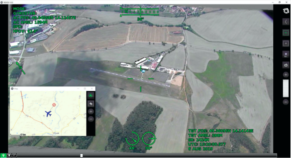
SAFESKYDRONE UAVs are all equipped with an encrypted high bandwidth communication link for both real time video transmission and command & control of the aircraft from the GCS. As standard, a 200 km telemetry and communication system is delivered with your UAV which gives you the capability to manage missions based around an airfield relatively close to your operational area. Upgrading your UAVs to the high-end BLOS (Beyond Line of Sight) networked communication & telemetry system means that the range and scope of your missions can cover areas with no local landing facilities or extend the distances covered in each survey. The extended operational area means that the crew and team can stay in one location, resulting in shorter mission periods and the ability to cover awkward shaped areas in one day, thus improving the speed of data collectionand reducing costs.
The long-range broadband communication is delivered through phased array technology with electronic beam steering and narrow radiation beams providing a capability which is unmatched by conventional systems. If you specify networked units, the system can handle signal obstructions providing stable and robust wireless connections for reliable operations in rural areas.
SPECIFICATIONS

Contact
For any inquiries email us
INFO@SAFESKYDRONE.COM